|
NavTools Route 4.15
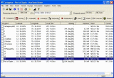
Useful voyage application with many tools and utilities that provides voyage planning, scheduling and reporting for merchant navy vessels!
| Version: | 4.15 |
Publisher: | navtools.nl |
| File Size: | 1,829 KB |
System: | Windows 98/ME/NT/2000/XP |
| License: | Free to try ($75.00) |
Limitations: | 30 days |
| Date Added: | 03-07-2006 |
Requirements: | no special requirements |
Software Description:
Create your own routes using unlimited number of waypoints, and monitor vessels performance while sailing this route. NavTools Route contains unique features which allow you to view average weather along your route (including ocean currents) for this particular season and estimate your vessels performance and fuel consumption.
A unique feature of NavTools Route is its build in vessel algoritm, which is able to calculate the most economical engine rpm setting for the whole voyage, taking into account expected weather conditions on each stretch of the voyage. Using this option NavTools Route will allow you to 'gain' additional speed on favourable stretches of the voyage, and loosing speed in areas of bad weather while still arriving on time and with minimal fuel consumption.
NavTools Route allows you to attach lists of required charts and documents to your voyage planning, your final voyage planning file will include waypoints, required charts and publications, and reporting points. Other lists are stored separately and will be available for any voyage.
And also NavTools Route allows you to print a 'plottingsheet' for any part of the voyage, which can be printed on transparant paper and used as an overlay on a paper chart. This plottingsheet will show waypoints and courselines, as well as past positionfixes, navigational warnings, and tropical storms.
Using NavTools Route you can plan your voyage to arrive exactly on schedule and with minimal fuel consumption.
Key Features:
- Enter waypoints and calculate required courses and distances.
Enter dates and time for Start of Seavoyage and Scheduled time of arrival.
- Calculate required speed as well as required engine rpm setting.
Calculate estimated fuel consumption during the voyage.
- View average weather conditions on each stretch of the intended voyage (scheduled engine rpm setting will include these weather conditions).
- Connect your PC to a GPS using a NMEA0183 serial connection and automatically update and log positionfixes to disk.
- Continously update required speed and engine setting during the voyage in order to arrive on time with minimal fuel consumption.
- Departure, Position, and Arrival reports can be created fully automatically for a large number of reporting systems (f.i. AMVER, SISTRAM, AUSREP, etc) and exported either to email or to textfile or printer.
- Enter a list of required charts and publications.
Enter a list of required reporting points during the voyage.
- Enter presently active navigational warnings and calculate ETA and closest distance from scheduled route.
Enter and update presently active tropical storms and calculate ETA and closest aproach during scheduled voyage.
- View and update all relevant data on departure and arrival port (including pilot traject, details pilotstation, etc)
Continously update the 'master schedule' and calculate estimated fuel consumption and required speed on roundtrip.
- Calculate squat during the voyage.
Calculate required distance and time to reduce engine rpm.
- Calculate wheel over point distances for each turn during the voyage.
All lists can be exported to email or text or database file for further editing.
Editor's Review:
NavTools Route is a complete voyage planning application for merchant shipping or yachting. Use this application you can create your own routes using unlimited number of waypoints, and monitor vessels performance. NavTools Route is very useful for voyage planning, scheduling and reporting.
User Comments:
[ Write a comment for this software ]
No user comments at present!
Related Programs:
- Bible Decoder - Explore the Hebrew Bible or any other text and search for embedded codes.
- NavTools GPS - Connect your PC to your GPs via a serial NMEA connection and automatically log position, course, and speed at preset intervals to disk.
- Auto Maintenance Plus - Auto Maintenance Plus - Auto Maintenance Plus should capitalize the PLUS.
- Daily Planner/Journal - The daily planner function lets you plan out your days for the next 100 years.
- MyPhone Book Dialer - It is helpful to store and manage your contacts' information yourself.
- TypingMaster Pro - A powerful networkable typing tutor with advanced teacher tools.
- LingvoSoft Dictionary English <-> Italian - It is a useful tool for Microsoft Smartphone!
- 'Diet Tracker' - 'Diet Tracker' is the best, the most flexible and the most friendly tool to register and control your meals as well as your exercises!
- Function Grapher Standard Edition - Use Function Grapher to create 2D, 2.5D and 3D coordinate graphs, animations and table graphs.
- PEDOMETER LOG - Pedometer Log provides a means to record your daily steps for a year.
|


 Download Site 1
 Buy Now $75.00
