|
Home > Business > Math & Scientific Tools > Eye4Gps GPS Mapping Software > Publisher
Eye4Gps GPS Mapping Software Publisher
GPS Mapping Software for Windows, realtime navigation and position recording
Publisher: Eye4Software B.V.
Website: http://www.eye4software.com
About Publisher: Eye4Software B.V.

Eye4Software B.V. develops: Eye4Software Coordinate Calculator : perform map coordinate conversions
; Eye4Software GPS API : Toolkit to add GPS functionality to software
; Eye4Software GPS SDK : Toolkit to add GPS functionality to software
; GPS Toolkit : an ActiveX / COM component
; Eye4Software GPS Toolkit : Toolkit to add GPS functionality to software
...
All Products from Eye4Software B.V.
 |
GPS Toolkit Standard License
Eye4Software GPS toolkit is an ActiveX / COM component which allows software developers to add GPS functionality to their programs and scripts without the need to have any knowledge on geodesy, serial communications, NMEA-0183 and GPS protocols.
Overview |
Download |
Screenshot
|
| 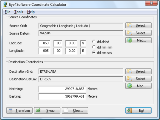 |
Eye4Software Coordinate Calculator
Eye4Software Coordinate Calculator is a very easy to use tool to perform map coordinate conversions. Supported projections: Transverse Mercator, Lambert Conformal Conic, UTM, Gauss Kruger, Stereographic, Albers Equal Area, Oblique Mercator and more.
Overview |
Download |
Screenshot
|
|  |
Eye4Software GPS API
Toolkit to add GPS and coordinate conversion functionality to software (GPS API). All NMEA0183 protocol versions are supported, Garmin USB PVT support. Support for datum conversions and coordinate conversion using different map projections.
Overview |
Download |
Screenshot
|
| 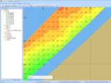 |
Eye4Software Hydromagic
Hydrographic Survey Software for Windows, Create singlebeam soundings, Realtime navigation and more. Hydromagic software can be used with various map formats including: GeoTiff, BSB Nautical Charts, AutoCad DXF files, ESRI Shapefiles and image files.
Overview |
Download |
Screenshot
|
|  |
Eye4Software GPS Toolkit
GPS Toolkit to add GPS and coordinate conversion functionality to software (GPS API). All NMEA0183 protocol versions are supported, Garmin USB PVT support. Support for datum conversions and coordinate conversion using different map projections.
Overview |
Download |
Screenshot
|
| 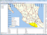 |
Eye4Gps GPS Mapping Software
GPS Mapping Software for Windows, Loading topographic maps, Realtime navigation and more. The software can be used with various map formats including: GeoTiff, OpenStreetMap XML, BSB Nautical Charts, AutoCad DXF files, ESRI Shapefiles and image files
Overview |
Download |
Screenshot
|
|  |
GPS Toolkit
Eye4Software GPS toolkit is an ActiveX / COM component which allows software developers to add GPS functionality to their programs and scripts without the need to have any knowledge on geodesy, serial communications, NMEA-0183 and GPS protocols.
Overview |
Download |
Screenshot
|
|  |
Eye4Software GPS SDK
Toolkit to add GPS and coordinate conversion functionality to software (GPS API). All NMEA0183 protocol versions are supported, Garmin USB PVT support. Support for datum conversions and coordinate conversion using different map projections.
Overview |
Download |
Screenshot
|
TAGS OF EYE4GPS GPS MAPPING SOFTWARE

dj software ,
bios software ,
diary software ,
java software. ,
submit software ,
software search ,
iphone software ,
avi software ,
software i pod
|
|
|
 RSS Feeds
BBS Forum
RSS Feeds
BBS Forum