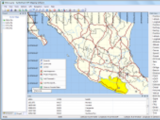
Detailed Description of Eye4Gps GPS Mapping Software 3.0
 Eye4Gps GPS Mapping Software is a professional GPS mapping software tool that can be used in numerous applications. Use the software to load, view and edit your maps, display your position realtime and record all your movements. Eye4Gps GPS Mapping Software will work with almost any GPS and can be used on any desktop, laptop or needbook computer running Windows XP or higher. Eye4Gps GPS Mapping Software can be used for both home and professional use.
Some applications GPS Mapping Software can be used for:
*Add comments, symbols or routes to your topographic maps;
*View GIS features on shapefiles, CAD and OpenStreetMap data;
*Manage the waypoints, tracks and routes on your GPS;
*Shows your current position on a map;
*Convert GPS data between different file formats;
*Perform realtime navigation on vessels, cars, trucks and construction vehicles;
*Record your current position, useful for surveys to show the covered area;
*Display recorded track-and-trace data;
*Plan your route using a topographic map by using waypoints and routes;
GPS Connection
The software can communicate with almost any GPS device to retrieve your current position, or to up and download tracks, routes and waypoint to and from your GPS devices. Supported protocols include NMEA0183 and Garmin PVT protocol.
Map Formats
Eye4Gps GPS Mapping Software supports a wide variaty of both vector and raster formats including:
*GeoTIFF;
*AutoCad DXF CAD files;
*OpenStreetMap XML files, and OpenStreetMap PNG tiles through calibration;
*ESRI Shapefiles;
*BSB nautical charts;
*JPG files, through user calibration or JGW (JPEG World File);
*TIF files, through user calibration or TFW (TIFF World File);
*GIF Files, through user calibration or GFW (GIF World File);
*PNG Files, through user calibration or PGW (PNG World File);
*BMP Files, through user calibration or BPW (BMP World File);
Eye4Gps GPS Mapping Software is designed for:
Win7 x32,Win7 x64,WinServer,WinVista,WinVista x64,WinXP
TAGS OF EYE4GPS GPS MAPPING SOFTWARE

job software ,
downlode software ,
games software ,
mp4ipod software ,
mac software ,
dj software s ,
map software ,
software downlode ,
ftp software
|


 RSS Feeds
BBS Forum
RSS Feeds
BBS Forum